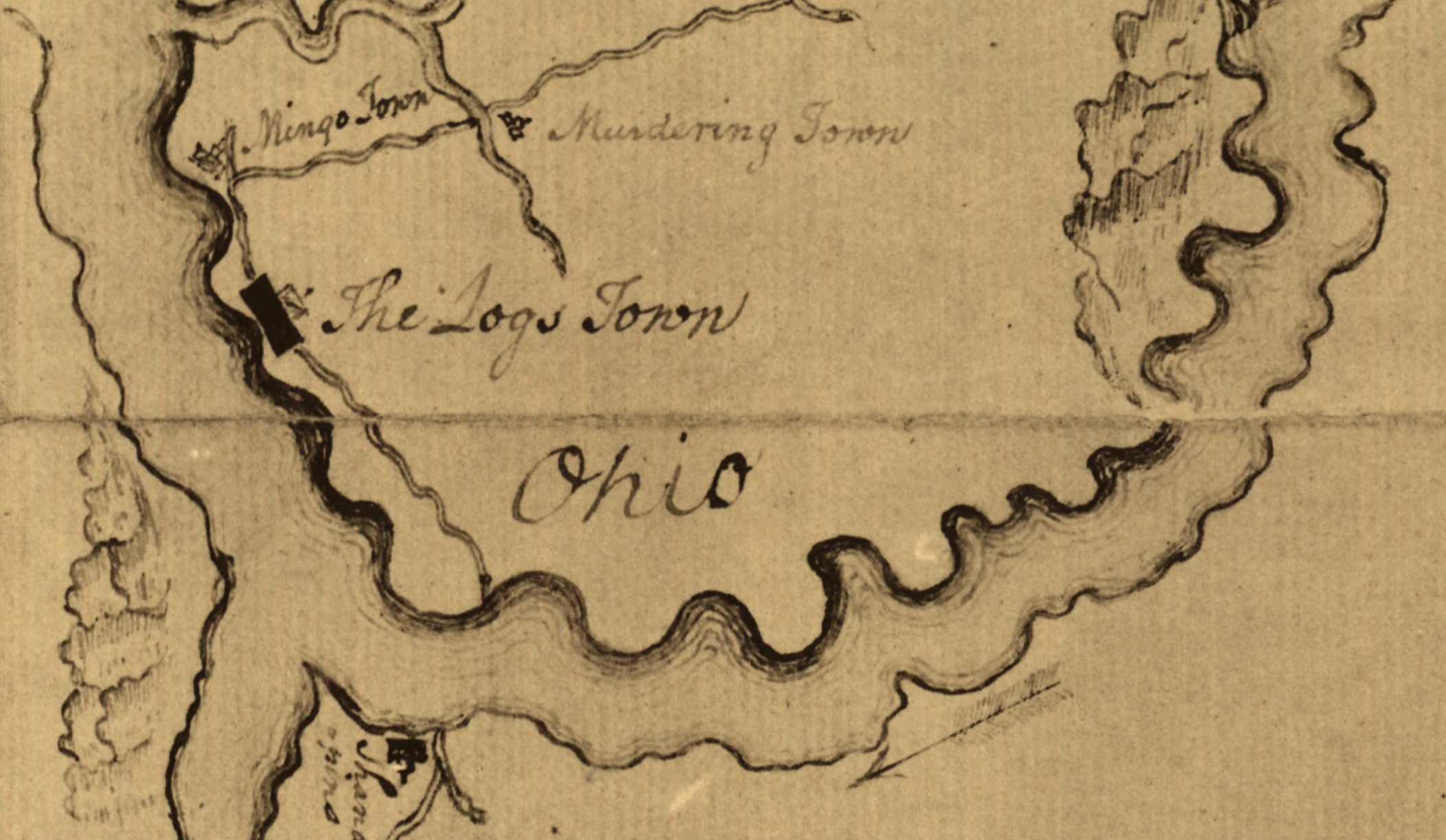
TL;DR -- We have looked at things western from St. Louis on out. Now, we need to see how people got to St. Louis. One method was the Ohio River. It's time to look at that waterway whose basis goes from NY to IL on the north and from VA to western KY on the south. The Ohio River carries water from SC, GA, AL, MS, and KY to the Mississippi.
--

The image on the left comes from a paper that looked at water use (Ohio River Valley Water Sanitation Commission, see orsanco[.]org). The redline shows the boundary of the basin. If we follow this boundary from the top right, it goes southwest from NY to NC. Here it goes through PA but gets water from MD, VA and WV. Then, it goes west through the south (SC, GA, AL, and MS) since the Tennessee River empties into the Ohio. As well, the Cumberland River of KY and TN ends at the Ohio.

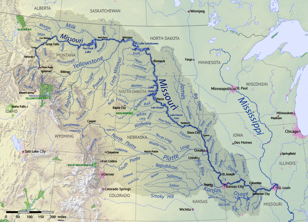
The image on the right shows the basins for the contiguous States. The numbering starts with the Columbia River basin plus those of OR, then those that flow to the Pacific (and others) in CA. The 3rd deals with interior flows, such as that for the Great Salt Lake. The 4th and 5th are for the Colorado River basin. The 6th is for the Rio Grande. The 10th, the largest, is for the Missouri (see below). The 8th is for the Arkansas.
Earlier, we took a brief look at an area where the 1st, 3rd, 5th, 8th, and 10th all have water courses with fairly close origins that split out into flows into these different areas. In the below map showing the basin for the Missouri River, we are talking the upper left part of the map.
Back to the Ohio, given that we can trace families along these courses to various parts of the country, we will also include activity that occurred early in their endeavor. Going back to a look at establishing KS as a Free State (post was in 2016), the group that left the Boston area went to New York and got a steamer to Chicago via the Great Lakes. Then, they took a coach across Illinois and Missouri to the Kansas City area. After that, it was by foot or horseback. Now, this was in the 1850s. Of late, we have been looking at matters up to three decades earlier.
However, for the Lawrence group, the travel would have been much faster.
In terms of the Ohio River, it was shown to be more efficient to move goods down from IN and IL on the Mississippi River to New Orleans and then by ship to New England than trying to push things back up stream.
Remarks: Modified: 07/01/2021
04/13/2021 -- Added image for our portal.
07/01/2021 -- Now, looking at the gateway to the west.
No comments:
Post a Comment