---
In our research of the expansion of the U.S. during the times of COVID, we referenced the commercial aspects of overland travel several times. That was mainly to carry mail, commerce and people. Of the activity that we looked at, we always found New England connections.
- St Louis MO to San Francisco CA - this was pre-Civil War. Our post showed the schedule and the route. From that research, we looked at several things including the people involved, early LA, the route itself, and more.
One of those connections was that in hilly Los Angeles, the downtown itself early on nestled under hills. One of these was given the name of Bunker Hill West and have had many posts. Old L.A. and the U.S. is an example. In that posts, one of the images was a very early photo which was of the area where the Overland Stage came in. Times Mirror (old employer of John) came to be in that area, too. There are other connections related to New England families who came out and developed the area.
These photos are all from the 1860s and shows that phase of the development of LA. Bunker Hill West? It is where all of those skyscrapers now sit, upon a hilly area that was leveled. In the period that we will look at, the hills were first tunneled under so that there could be regular traffic (days of horse power, but commerce was increasing as was the population).
Today, we saw a colorized copy of a photo provided in the "Old L.A. and the U.S." post. The photo is next. All of the subsequent photos are from the same source (Water and Power Associates) which we will do another post on, especially now that we have GenAI/LLM trashing the internet.
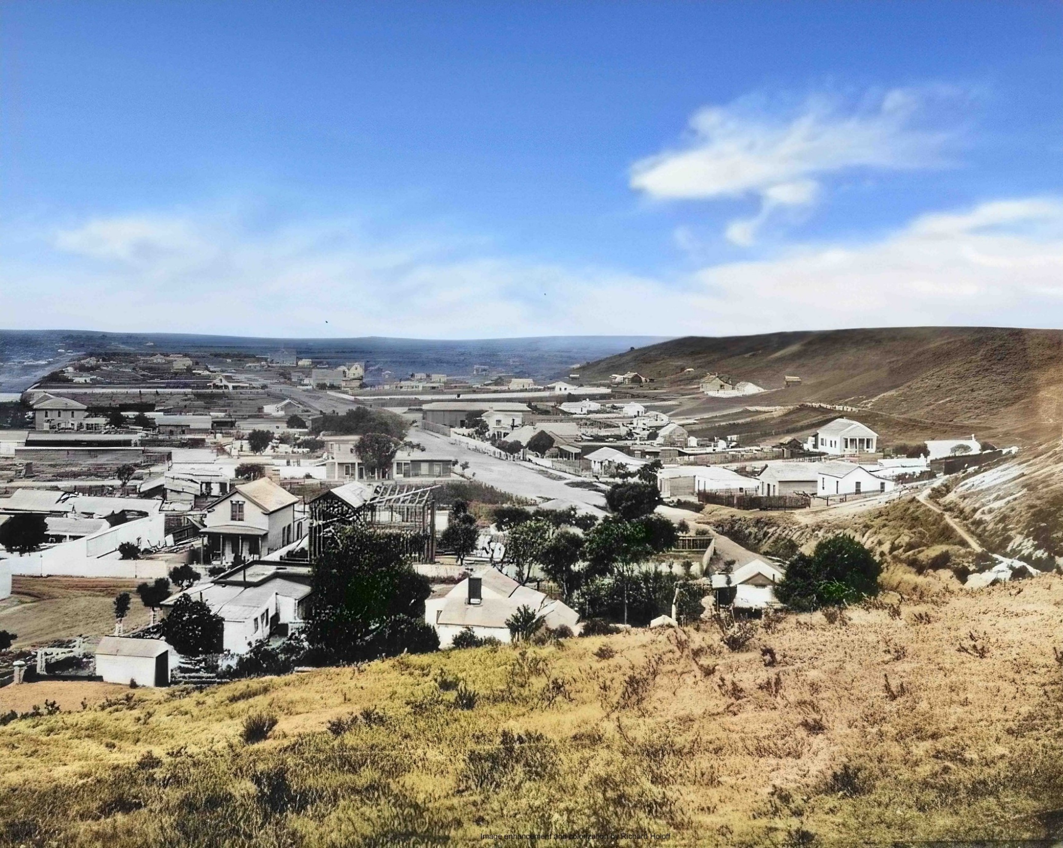 |
| Taken from Poundcake Hill On the right, we see part of Bunker hill 1868 - colorized |
Now, this photo has the legend of these building which are numbered. "65" labels where the Overland activity took place. This area was a stopover both ways, the St. Louis route went to San Francisco and back.
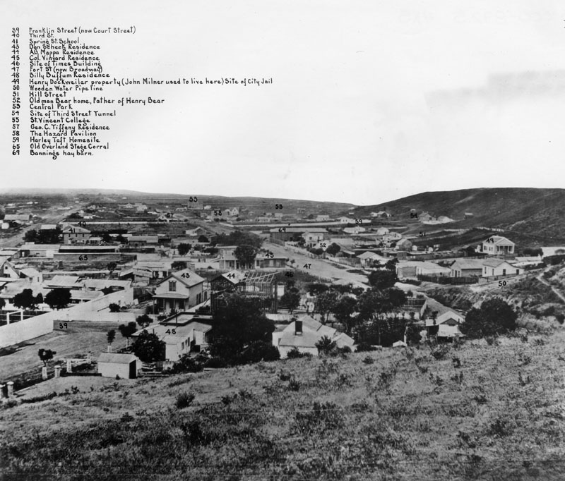
The following photo is of the same area, but it is from a position on Bunker Hill West. From Poundcake, one would have gone to the right to Bunker Hill and then taken a few steps along the hill. Again, there is a legend.
.jpg)
Now, the next photo shows the same area, but off the hill, in the 1870s. The first high school had been built which sat upon Poundcake hill.
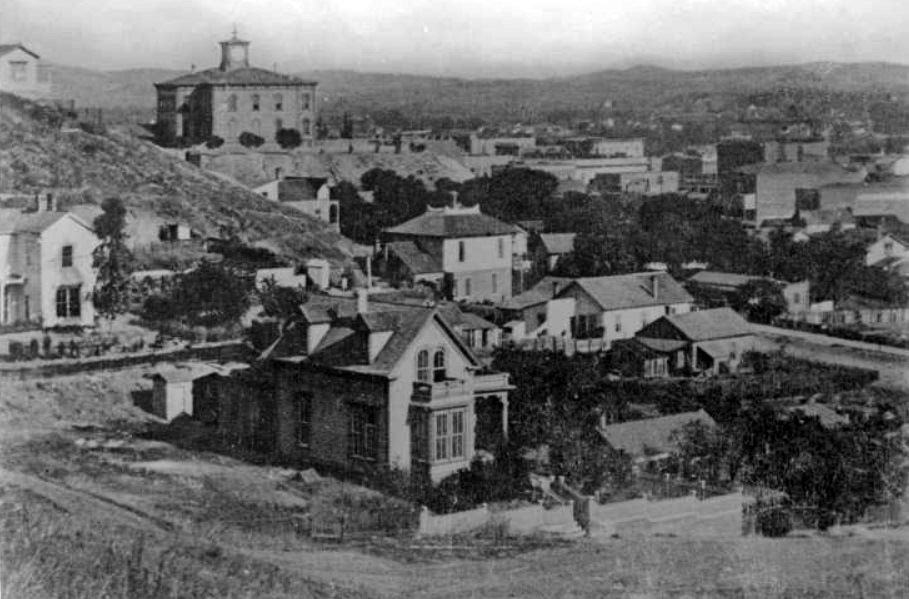 |
| High school (with the tower) on Poundcake Hill 1878 |
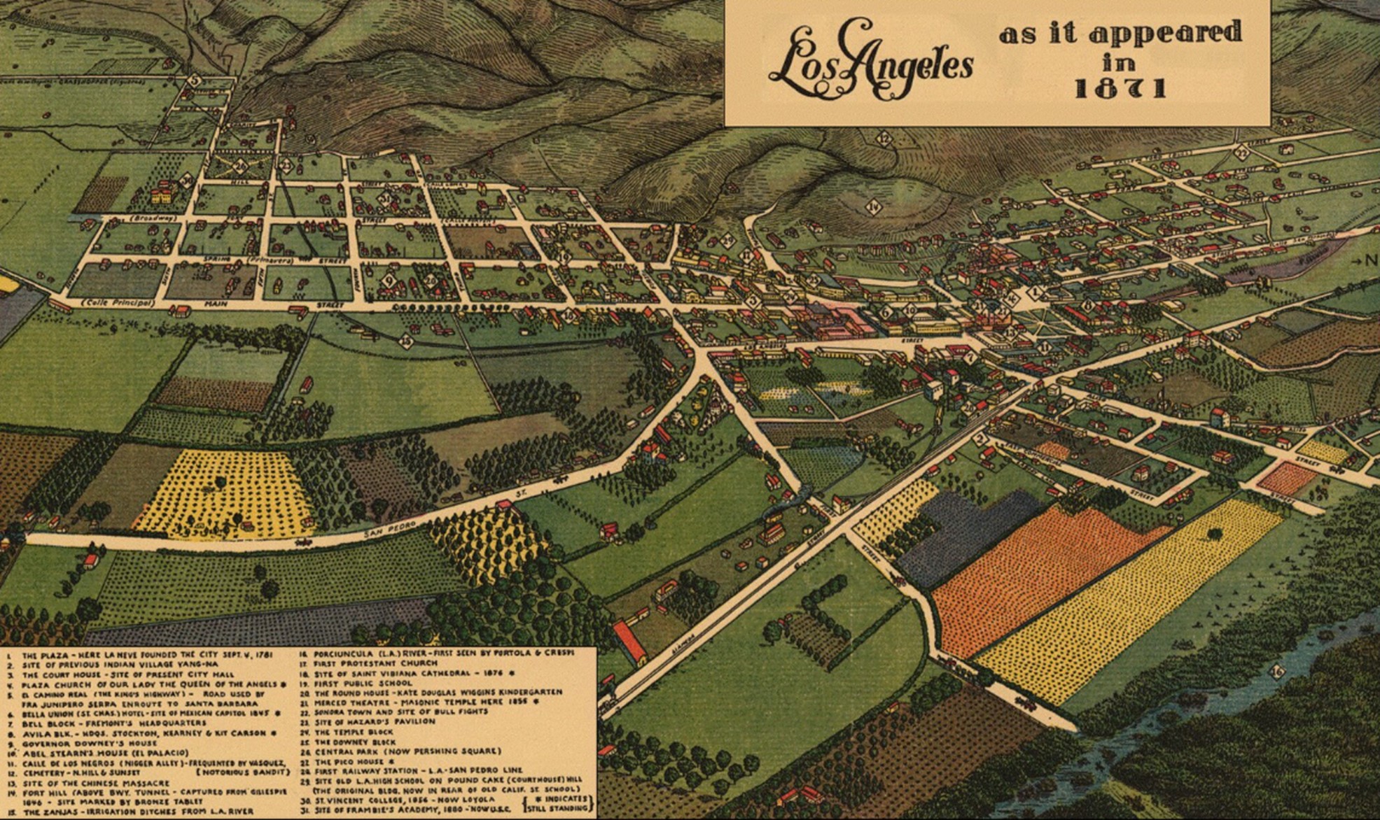
In our next posts, we will look at the end of the Mexican era which corresponds with the arrival of Jedediah Strong Smith. New Spain was in the region long before this time. The earliest involvment of New England can be associated with the Bella Union Hotel. An adobe structure was built in 1832 and was the residence of the New Englander. The building was also an office for the Mexican government. By the time of the Overland Stage, it had built up to be used for office work.
We have mentioned the hotel and offer this map from 1871. Being an illustration, it doesn't show the contours and limits of Bunker Hill West, but one can see how LA was in a valley and had a agriculture focus. Streets were established early; this scene shows Main and Spring as they come in from the countryside and meet where the LA City Hall now stands (built in the 1930s).
But, the main focus will be the transitions through time by culture and the artifacts (buildings). LA is unique in having such speed of alteration.
Remarks: Modified: 04/27/2025
04/26/2025 --
No comments:
Post a Comment