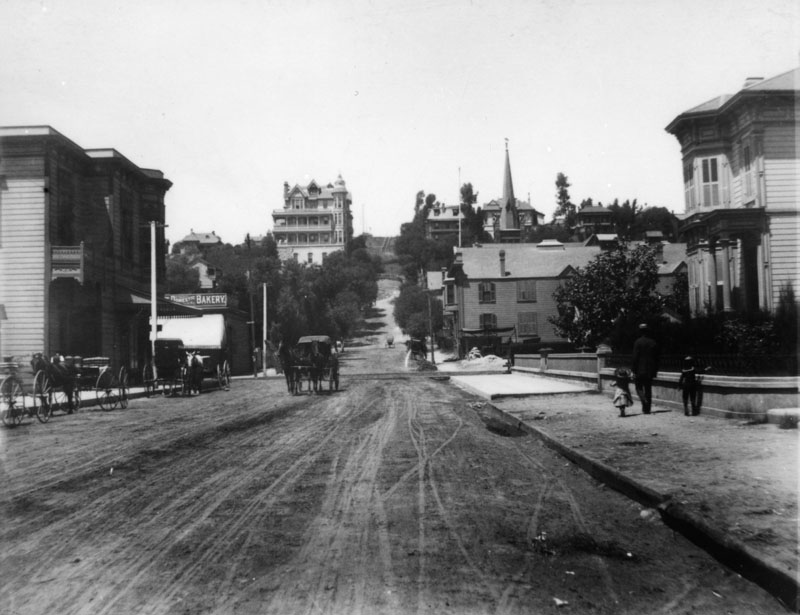
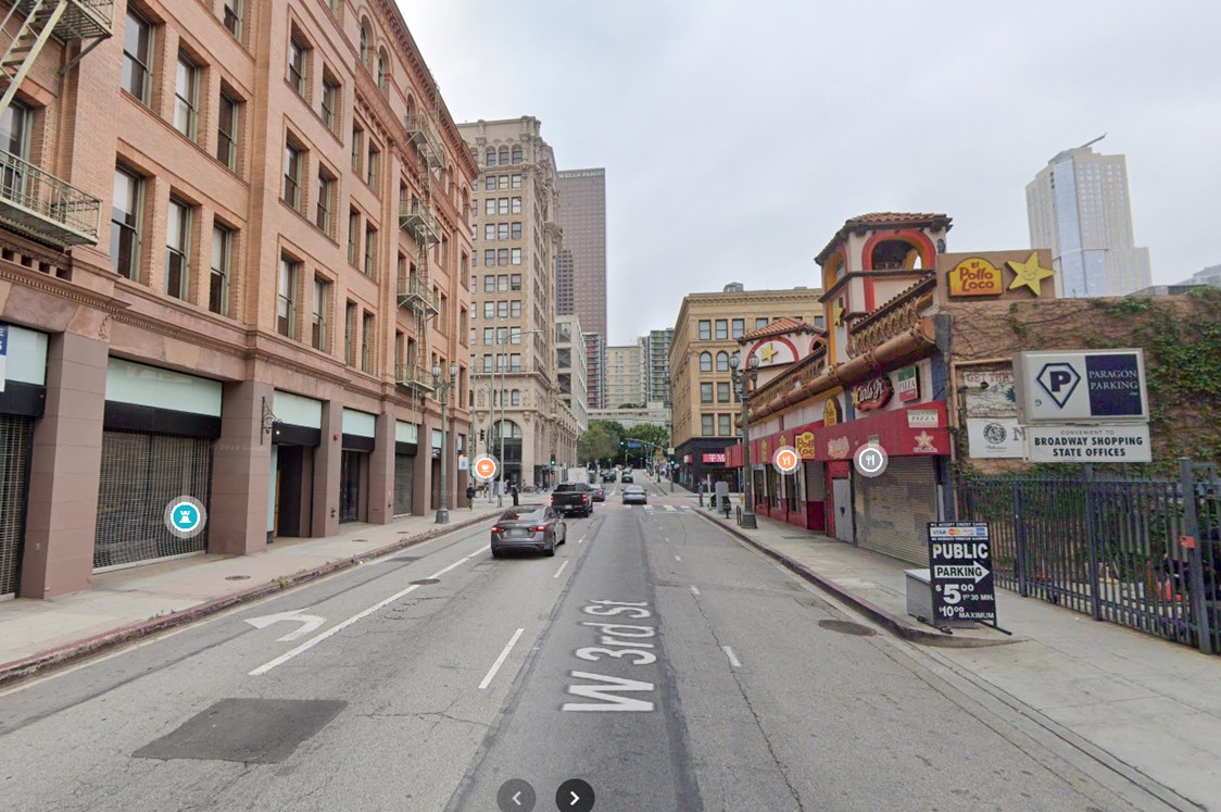
TL;DR -- LA, again, with a supposed view from 1888 which shows the development at the time given alongs side with a later view with a building built in 1893 which is still standing. Bunker Hill comes into vierw, of course.
--
So, LA a town of tales? It might seem that way since it's the hub of creative efforts out of Hollywood. Wasn't there a movie with "LALA Land" in the title if memory is correct?
We have written of Bunker Hill west a bit. The original motive was due to the progression of change that came with the Revolution, start of the U.S., the westward movement (by land and by sea) and then the fast pace of change seen everywhere. One of these changes was the eruption on the landscape of high-rise building. LA has a few which block sunsets for quite a few folks. The mountains always blocked sunrise on the east.
Not long after the west opened, with St. Louis as an organizing center, traffic flowed from early trappers to fur traders and then land seekers with remnants of these changes all across the country. Tales abound that need to be told. Leaping to the coast is easily thrown in as both LA and its cousin up north, SF, were major ports. From there, people moved inland. See Napa Valley pioneer. Ann's lineage has developers in both California and Florida.
But, there was another motive which deals with memory. John worked and lived in DTLA in the early '60s when the City Hall's height was a limit. Too, DTLA was bustling without being a canyon (out west, these are usually associated with some waterway) city. The mountains were majestic and visible. For a while, they seem to disappear with the appearance of smog. But, this year, we have seen lots of winter views from the DTLA area. John's main work are as the Times-Mirror building, but he was in lots of downtown buildings where he picked up or delivered "ad" copy for coming editions. John lived at the base of Bunker Hill, or on Bunker Hill, or to the west (northwest) of DTLA on the shore of the Westlake near MacArthur park. UCLA had an extension in DTLA with regular classes.
And, DTLA is getting attention due to the internet's abilities to allow photos to be shown and localities to be discussed. Like one area not far from DTLA and higher. One sees the old LA in the streets and dwellings with huge monoliths blocking the view. One of our posts showed the City Hall surrounded by land being developed and a corner not far away which we named as "High rise corner" in honor of the effort. That post also has a snap from Google maps showing the relative shadows of these prominences. That is, how long is the shadow? Fortunately, the density is such that a blue view is not obstructed for long.
We'll show three photos that go along with this theme. These photos come from archives at the Library or at the Water and Power Associates.
Now, another purpose for the interest is that we need to get these photos out and described before GenAI's artificial view of the world is replaced. Case in point? There's a photo of supposed 1901 LA that shows this sparse setup. But, we know from drawings of the time of Butterfield that there were buildings in the area that we show below. Too, efforts at the tunnels such as the on on 3rd street were going on for a long time.
Okay, to the photos. Let's first look at the Bradbury building which was built in 1893. In the '60s, it was one of the many business buildings in DTLA.
 |
| Bradbury building, DTLA |
 |
| 3rd Street, DTLA, 1880s looking toward Broadway |
 |
| 3rd and Broadway, DTLA |

No comments:
Post a Comment